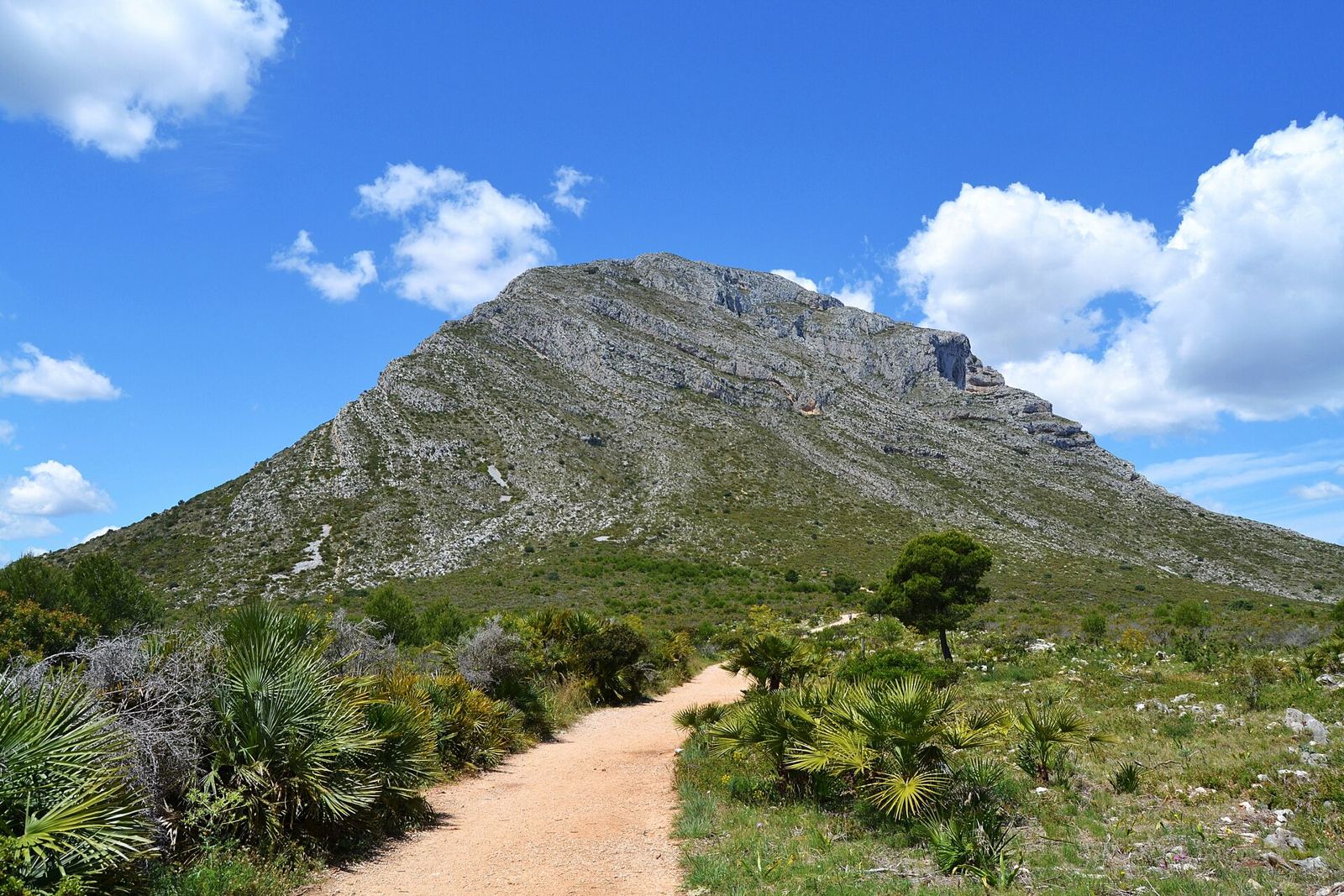
The Montgó area covers the urbanisations on the lower slopes of the Montgó mountain, on the edge of the Montgó Natural Park, between Jávea and Dénia. Homes are mostly villas on elevated plots with views over the valley and sea.
Where is the Montgó area?
North and west of the Old Town, rising towards the Montgó massif and its natural park.
The Montgó area covers the slopes around the Montgó, so no single pin is shown. Map data © OpenStreetMap contributors.
What is the Montgó area like?
Quiet, green and residential, with walking routes into the natural park; south-facing slopes are popular for year-round living.
A little history
The Montgó massif rises to 753 metres between Jávea and Dénia. The Montgó Natural Park, declared on 16 March 1987, covers 2,117.68 hectares from the mountain to the Cap de Sant Antoni and Les Planes, with a buffer zone of more than 5,000 hectares added around it in 2002. From Jávea, the mountain is often said to look like an elephant's head and trunk.
People have lived on its slopes for a long time: Iberian villages stood on its peaks from the 7th century BC, and the Cova de l'Aigua, a small cave used as a shrine and later as a water store, has a Roman inscription at its entrance.
Getting around the Montgó area
By car; Dénia and the Old Town are both a short drive.
Beaches and coves near the Montgó area
The nearest beaches and coves to the Montgó area, measured in a straight line from the centre of the area:
- La Grava (about 3.8 km away): the beach at the Port, next to the promenade, with lifeguards in the summer season.
- Benissero (Primer Muntanyar) (about 4.1 km away): a pebble beach that is popular with residents because it gets less crowded, with lifeguards in high season.
- The Segon Muntanyar (about 4.6 km away): a stretch of flat rocks and small coves used for swimming and snorkelling.
Things to see near the Montgó area
Places to see within easy reach of the Montgó area:
- The Ermita de Santa Llúcia, about 1.5 km away: a 17th-century hermitage on a 163-metre hill above the Old Town, with views over the valley and the bay.
- The Ermita del Pòpul, about 2.0 km away: a small hermitage on the southern slope of the Montgó, built in tosca stone with a pointed arch and remodelled in the 18th century.
- The municipal market, about 2.3 km away: the covered market in the Old Town, a 1946 building in a style inspired by civic Gothic.
Everyday essentials
The nearest large supermarkets are Masymas (about 2.2 km), Mercadona (about 2.8 km) and Lidl (about 3.0 km). The closest public health centre is the Xàbia health centre in the Plaça de la Constitució, which also has the town's urgent care, about 2.0 km away. The nearest state primary school is CEIP Mediterrània, about 2.4 km away; school places are allocated through the regional admissions process, not by distance alone. For hospital care, Jávea is covered by the Hospital de Dénia.
How far is the Montgó area from…
| Place | Straight-line distance |
|---|---|
| The Old Town (Plaça de l'Església) | about 2.4 km |
| The Port | about 3.9 km |
| The Arenal beach | about 5 km |
| Club de Golf Jávea | about 6 km |
| Hospital de Dénia | about 8 km |
Distances are measured in a straight line from the approximate centre of the Montgó area; by road they are longer, especially from the hillside urbanisations.
What do homes in the Montgó area usually need?
- Hillside plots need good drainage and retaining walls; check before the storms.
- Pine areas bring processionary caterpillars; see our caterpillar guide.
- Large gardens and irrigation keep gardeners busy.
What is on the ground in the Montgó area
OpenStreetMap shows no shops, bars or restaurants within about 1200 metres of the centre of the Montgó area: it is purely residential, so everyday shopping means a drive.
Many streets on these slopes are named after Spanish towns and cities: Lastres, Córdoba, Linares, Avilés.
Counts from OpenStreetMap, which volunteers keep up to date; small or new places may be missing.
Nearest everyday services to the Montgó area
The closest business of each kind on Javea1 to the centre of the Montgó area, measured in a straight line from its Google Maps pin:
| Service | Nearest | Distance |
|---|---|---|
| Pharmacy | Farmacia Colomer 3 | 2.1 km |
| Doctor or private clinic | Clínica La Ermita | 2.0 km |
| Dentist | Clínica Dental Jaime Ortuño | 2.3 km |
| Vet | Centro Veterinario Albeitar | 2.2 km |
| Hardware shop | Ferrobox Jávea (Stihl) | 2.5 km |
| Mechanic | Vehículos Andrada | 2.0 km |
| Bank | Banco Santander - Smart Red | 2.2 km |
| Optician | Óptica NL Visión | 2.2 km |
| Physiotherapist | Fisioterapia y Osteopatia Javier Codina | 2.3 km |
| Hairdresser | Peluquería Nucs Jávea/Xàbia | 2.2 km |
| Pet shop | Pajareria Y Piensos Domènech | 2.3 km |
| Laundry or dry cleaner | Tintorería Lavandería Colomer | 2.1 km |
Where to eat near the Montgó area
See restaurants in the Montgó and countryside, with Google ratings and map links, or browse all restaurants in Jávea and our guide to eating out in Jávea.
Local services for the Montgó area
Quick answers
Where is the Montgó area in Jávea?
North and west of the Old Town, rising towards the Montgó massif and its natural park.
Do I need a car in the Montgó area?
By car; Dénia and the Old Town are both a short drive.
What is the nearest beach to the Montgó area?
La Grava, about 3.8 km away in a straight line: the beach at the Port, next to the promenade, with lifeguards in the summer season.